
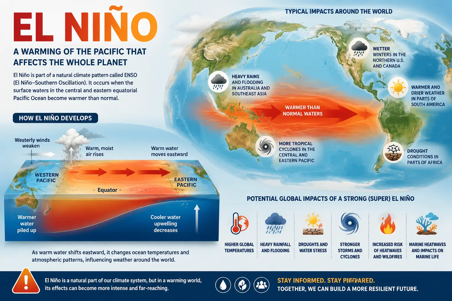
One of the planet’s most powerful climate patterns is expected to return within months, raising concerns among scientists that the world could face more extreme weather, higher temperatures and growing pressure on food systems already strained by geopolitical instability.
Forecasts suggest there is now a strong probability that El Niño conditions will emerge during the coming months, potentially reshaping weather patterns across multiple continents.
Climate experts warn that the phenomenon could amplify existing warming trends and increase the likelihood of severe weather events worldwide.
Scientists Expect El Niño To Develop Soon
The World Meteorological Organization says there is now roughly an 80 percent probability that El Niño conditions will emerge between June and August.
The likelihood increases further later in the year, with forecasters suggesting a very high probability that the event could persist into late 2026.
El Niño occurs when sea surface temperatures across the tropical Pacific Ocean become significantly warmer than normal, disrupting atmospheric circulation patterns worldwide.
These shifts can influence weather thousands of miles away from where ocean warming actually occurs.
Why El Niño Matters Globally
El Niño is important because it often pushes already warm global temperatures even higher.
Scientists increasingly worry that the combination of long-term climate warming and developing El Niño conditions could create unusually intense heat periods.
“El Niño conditions will pour fuel on the fire of a warming world,” United Nations Secretary-General António Guterres warned.
Historically, major El Niño events have been associated with more intense droughts, heavier rainfall events, marine heatwaves and agricultural disruptions.
Different Regions Experience Different Impacts
The consequences of El Niño are highly uneven across the world.
Some regions typically experience significantly wetter conditions while others face drought risks.
Southern parts of the United States, portions of South America and areas of East Africa often experience increased rainfall.
Meanwhile, regions including Australia, Indonesia, parts of southern Asia and portions of Central America frequently become drier than normal.
Changes in hurricane activity may also occur, with El Niño generally increasing activity in parts of the Pacific while suppressing Atlantic hurricane formation.
Could This Become A “Super El Niño”?
Some observers have begun describing the upcoming event as potentially becoming a “super El Niño.”
Scientists, however, generally avoid using that terminology.
Instead, forecasting agencies classify events based on measurable temperature anomalies across the Pacific Ocean.
Current projections suggest many forecasting centers expect at least moderate conditions to develop, with stronger outcomes remaining possible depending on ocean warming during the coming months.
Economic And Travel Impacts Could Extend Beyond Weather
Major El Niño events often create consequences that extend far beyond temperature records.
Disruptions to agriculture, fisheries, commodity markets, infrastructure and transportation systems frequently follow prolonged climate shifts.
Previous strong El Niño episodes contributed to drought-driven crop losses, supply chain disruptions and rising food prices in certain regions.
As global economies continue navigating geopolitical tensions and higher energy costs, additional climate-related disruptions could create further pressure.
The World May Soon Enter Another Climate Cycle
El Niño and its opposite phase, La Niña, naturally alternate over periods typically ranging between two and seven years.
These cycles do not follow predictable schedules, making precise timing difficult.
What scientists increasingly agree on, however, is that if El Niño does return this summer, the effects are unlikely to remain confined to the Pacific Ocean alone.